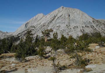
The West Ridge Route of Mt. Conness is the left skyline.
View from highest Young lake campsite.

On October 1, 2000, Bob Ayers and I had a great day climbing the West Ridge route on Mount Conness.
The last day of September we perused the photo of the route in the second edition of R.J. Secor's climbing guide to the Sierra Nevada. The route finding promised to be easy, just flow the south edge of a ridge all the way to the summit. My friend Eugene Miya urged me to stick to the edge of the ridge all the way up and enjoy the view down the south face. We picked up our 50 pound backpacks at the base of Lembert dome and hiked up over 2000 feet in elevation to the highest Young Lake where there are fabulous campsites. I noticed the altitude, but Bob, who is the best at adapting to altitude of anyone I know, hardly noticed the 10,300 foot elevation at all.
The next morning the rising sun illuminated the start of our route.
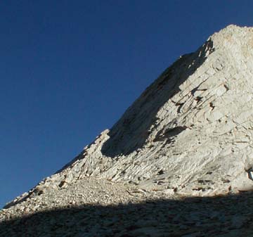
We left camp at 8 AM and arrived at the base of the flatiron shaped formation at 9:30 AM just as the sun arrived. We followed the skyline ridge in the photo above (the route starts in the sunshine and continues in the shade.) I volunteered to lead the first pitch. The climbing was easy and well protected. We swung leads up the flatiron formation for 6 pitches taking about 20 minutes a pitch.
Leading pitch 4, Bob did not like the looks of a section on the ridge so he dropped down to the right side. He found a fixed stopper and set up a belay. When I arrived there was no place to stand so I set a poor friend in a grainy crack and made a hanging belay. I also had Bob tie my rope into the three piece belay he had set. Good thing I did that, the grainy rock spit out my friend and I dropped 4 feet into the air. Bob Lowered me to a better stance a few feet down. The next pitch was the crux. There was one section beneath an overhanging flake that had little pro poor handholds but great footholds, it went at 5.6+ or so.
The climbing along the ridge was classic, and easy. The view down over the south face of Conness was breath taking. Behind us we looked down the ridge toward Roosevelt Lake.
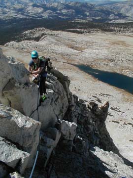
On Pitch 10 the ridge became easier and we started to simulclimb.
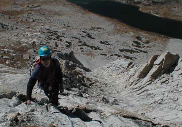
Bob stretched the lead on the tenth pitch for about 3 pitches worth of climbing. Then he came to a glorious wall that he had to stop to let me climb.
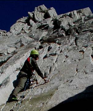
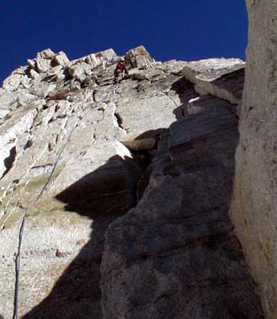
Paul leads the beautiful cracked wall 11 pitches
up.
Bob lead the next pitch, up toward the overhangs above.
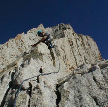
There was a crack route through the overhang but Bob suggested that it might be possible to traverse the right face. He was right, on my next lead I stepped out onto a sloping ledge with large crystals and traversed around the overhang. The traverse ended at a corner but easy holds lead straight to the top of the overhang.
Above we started climbing simultaneously. Bob lead pitches 14 and 15 which were each about 2 pitches long. After five and a half hours, 15 belays and 19 pitches of climbing we arrived at an easy talus covered summit area. We had averaged 20 minutes a pitch on easy rock with fantastic exposure.
A half hour later we arrived on the summit. It was 4 PM.
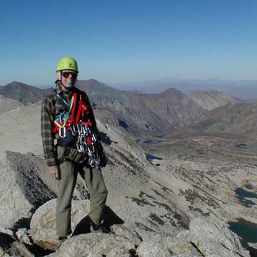
We were astonished to find that there was a sign in register on the summit just for people who had climbed the west ridge. A dozen parties had climbed the route in September. We were astonished to find that 5 people had proceeded us up the mountain! One group had started September 30 and had bivied on the route. For one of them it was the first outdoor rock climb. They were really lucky that last night had been relatively warm and calm. Two people had soloed the route. Most of the parties had started from Roosevelt lake and had started the climb two hours before we did.
It was a great pleasure to climb with Bob Ayers. He placed pro quickly and expertly and removed my pro just as quickly. He also set solid triple anchor belays in minutes. Bob admitted he was a bit tired on the summit, and hypothesized that perhaps this was because the 19 pitch route we had just done was his first outdoor roped climb of the year.
From the summit we walked down an unexpected stairway constructed by USGS survey crews, then south down a wide sandy valley. At the end of the valley the trail split, with the right fork going down to Roosevelt Lake and the left fork going back to Young Lakes. We took the left fork. On the way down I spotted a very strange lake, it has no name on the map but is in the valley just east of Young Lakes.
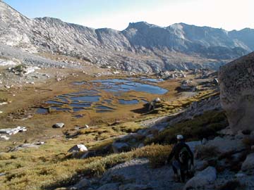
The lake was slowly becoming a meadow. (See the chapter on hundreds of years in my book Traces of Time.) There was a stream flowing down the valley that missed the lake entirely, it is the dark line on the far side of the lake in the photo. Ridges of grass created an interesting pattern in the lake.
We returned to camp at 6 PM. Ten hours round trip. We slept well with pleasant thought of a fine climb.
Read about my return to Conness via the West Ridge.
Return to Climbing
|
Scientific Explorations with Paul Doherty |
|
3 October 2000 |