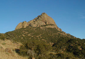
Baboquivari from the west. We climbed the right skyline.
Click the image for a much larger view.

Baboquivari from the west. We climbed the right skyline.
Click the image for a much larger view.
We flew in to Phoenix and drove to the west side of Baboquivari peak. As we turned off the paved road onto the 10 mile long Baboquivari approach road we paid our $10 a night camping fee at the Tohono O'odham, aka Papago, reservation District Headquarters. I had to sign a waiver acknowledging that we did not hold the tribe responsible for death, injury or emotional trauma from "sighting of the lion."
The campground is at 3700 feet, 4000 feet below the summit. We were saddened to see that the old house that sheltered many climbers during inclement weather has burned down.
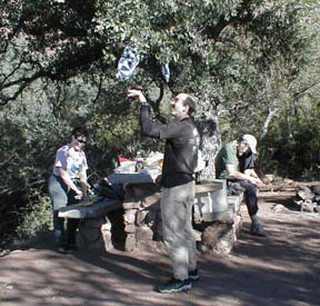
At the campground we were joined by a desert hiking group of 30 people in a tour bus, they went to bed before we did and got up at 4 AM! We got up at 6 AM and just barely beat them onto the trail at 6:40 still before sunrise. To the west we watched the dark shadow of the eart set and the spectacular steep shadow of Baboquivari move toward us across the desert.
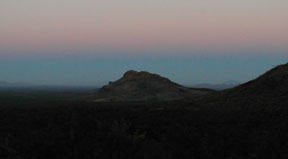
The shadow of the earth on the air at dawn.
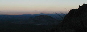
The shadow of Baboquivari at dawn. Click to enlarge.
We reached the ledge system which lead to our climb at 10 AM. It's known as "Lion's ledge" I wonder if that has anything to do with the release form?
We stopped to change into our climbing shoes, pack our climbing packs, one per team of two, and send back the leaders of the Desert Hikers who had missed their turn to the start of their climb. They were going up our descent route.
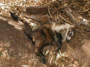
Coatamundi "sleeping" on Lion's Ledge. Click to greatly enlarge.
As we hiked along lion's ledge I found a coatamundi, with all four legs in the air. It was stiff and dead, but still in good condition. A beautiful animal with no blood or teethmarks on it. We guessed that it must have fallen from the cliffs above. A warning to us all.
Lions ledge had a climbers trail, it was technically a bushwhack, but not an evil bushwhack.
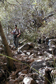
We arrived at a giant slab leaning against the cliff and scramble up its left side for a hundred feet or so to the start of the climb.
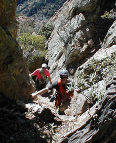
Hal takes the first lead but starts out too far to the right and Martin takes over while he retreats. Martin finds the route to the left of the saddle we start from and leads up a beautiful route, steep, but with good protection and fun moves. Morresa leads pitch two up a solid rock gully to the arete itself.
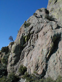
Ahead of us a steep wall contains another crux.
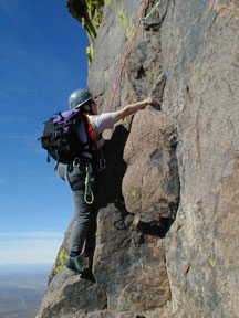
The route continues up the ridge with steep bits alternating with easier terrain, all with good pro, fun climbing and excellent views. What a day, temperature in the 60's with a gentle breeze and clear air. Wow.
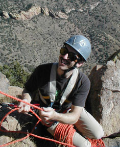
At the end of pitch 4 a short traverse left brings us to the base of the "layback" pitch. It's Hal's lead, he's made the climb more interesting by only bringing along a set of stoppers and four hexentrics. The memories flood back as I remember what it was like climbing before the days of camming protection. I enjoy crafting every placement, rejoicing, I remember how to do it!
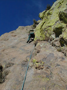
Hal leads the layback, it is reasonably low angle and includes footholds on the wall too, and good pro placements, who could ask for anything more?
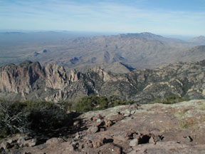
At the top of the pitch we coil the ropes and make our way toward the summit and down into a notch. The last pitch climbs a short wall out of the notch then we coil the ropes and head for the summit. We reach the top at 2:45 PM. 7700 feet.
Martin found the way down. To the north and a little east there is a low angle rock slab we walked down. At the bottom a dirt trail leads us to the top of the one 5.6 pitch on this the Forbes-Montoya route. We see the last of the desert hikers pulling their rappel rope. 15 of them have made it to the summit. We follow them down the rap then down the "great ramp" which has some pretty steep scrambling over rock.
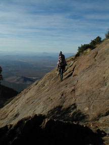
We arrive at our packs and shoes at 4 PM. It's a long way to camp and we will be getting there after dark.
Sure enough, a half hour out of camp Morresa and I turn on our headlamps, while Hal and Martin continue on in the dark. We're pretty tired, but happy, as we heat up turkey slices in gravy and drink fine Ridge Lytton Springs wine for Thanksgiving dinner.
|
Scientific Explorations with Paul Doherty |
|
5 Dec 99 |