Flying to the rocks.
Flying with the Geologists
20 December 2001, McMurdo Station Antarctica.
The invitation caught me by surprise, Prof. Terry Wilson invited me to fill an open seat on her geology team's last flight to study the distribution of volcanic cones around McMurdo sound. I had watched the team work day and night, marking the location of possible cones on air photos then flying out to get "ground truth." To see if they really were cones or not. I'd seen them return from one four hour field mission only to turn around and fly out on another, day after day, they were working hard to make the best use of every hour of reasonable weather they could get. As a result of their continuous work they were going to complete their survey.
I recognized their photos, I had bought several identical ones myself when I was a teenager. I still had them. One in particular showed the amazing shape of the Canada glacier as it flowed into the Dry Valleys, a huge mass of ice flowed down hill spreading into a fan and then vanishing into a dry wind. The greatest magic trick on earth, a glacier vanishing into thin air. When I saw that photo for the first time I decided that I wanted to visit the Dry Valleys. Here was an invitation to visit Mt. Morning right next door to the Dry Valleys. I accepted.
After accepting I wondered if there was something I could do to help. I ran to the galley and had them make flight lunches for the team. In true Exploratorium Teacher Institute tradition I thought about food first.
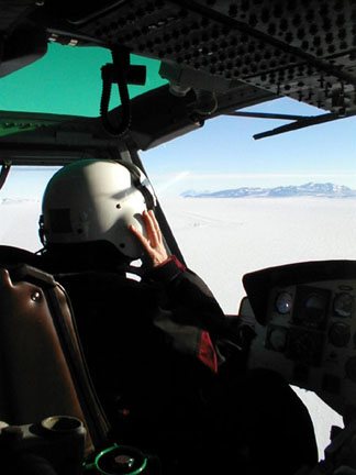
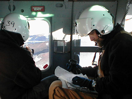
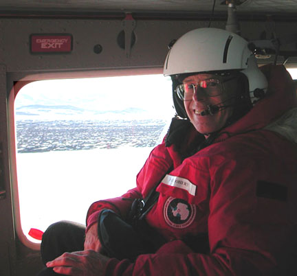
The team boarded a 212 helicopter, which I new as a Huey from the time of the Vietnam War. It was spacious but the pilot Chris, and the geology team of Terry, fellow geologists Tim Paulsen, and Jon Koenig plus Peter Braddock, the mountaineer, and I, filled the space with annotated books of air photos, cameras, computers, notebooks and sledge hammers, big sledge hammers. This promised to be an interesting trip.
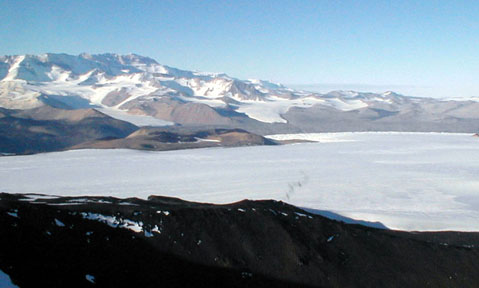
We flew across McMurdo sound at 110 mph. Then swept over the Brown Peninsula, a huge glacial moraine, which reach out like a hand from Mt. Discovery toward McMurdo station. Soon, Mt. Discovery filled the left window, a 9000 foot high volcano which dominates the view from McMurdo. The Little Dry Valleys and the foothills of the Royal Society Range filled the right window. The valleys were so close I could taste them. After decades of waiting I could see the disappearing glaciers with my own eyes.
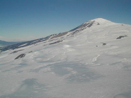
Our target was Mt. Morning a volcano covered with volcanic cones. Prof. Wilson was looking for alignments of the cones. McMurdo is in a rift valley, a place where the crust of the earth is pulling apart. The east rift zone in Africa is also a rift valley but the one in McMurdo is full of sea water and glaciers. If you want to know how the earth works this is a great place to do research. Antarctica has fewer earthquakes than any other continent, why is this? What role do the glaciers play? Perhaps this research project would add one important bit of information toward answering these vast questions.
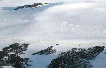
When we came to the cones themselves the raised circular rims of the first ones stood out of the glacial ice likes ships at anchor in a flowing river, only this was a river of ice.
The team moved into high gear and started working quickly but efficiently. Terry called out directions to the pilot and also the numbers the team had assigned to each suspected cone. Peter and Tim took videos and still pictures of every cone and recorded details in the log book, Chris the pilot called out GPS locations. I took photos and wrote this story. We worked at full speed for an hour and then Terry called for a landing at a cone with a prominent rock outcrop. It was time to get out the sledge hammers.
Chris dropped down and picked out a landing site on the stony ground. We approached the shadow of a helicopter and set down with silky smooth precision. I remembered watching the first moon landings: shadows, kicking up dust, contact! It was like that, the shadow and smooth contact, but the dust had long since been blown away in the Antarctic wind, it was replaced by blowing snow. The helicopter shut down and there we were in unearthly silence on an unearthly landscape.

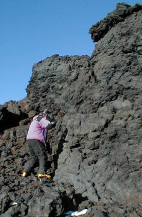
Peter and Jon headed off to the bedrock outcrop. Peter whacked the ledge with the sledge and acquired a sample of lava with crystals of feldspar. The date at which the feldspar crystallized is decoded by measuring the decay products of the radioactive isotopes in the crystal. Jon marked a line on a piece of the outcrop, the orientation of magnetic field locked in the iron atoms in the lava would be measured to find the magnetic field of the earth at the time the rock cooled.
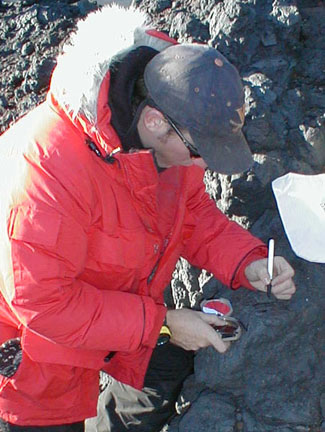
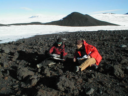
Tim downloaded his images into a computer, then joined Terry to note down everything they had found. The geologists recorded their data in notebooks the instant it was acquired. After years of teaching science laboratories at the university it was great fun for me to watch this superb example of professional scientists in action. I was impressed by the quick precision of the work done in these harsh lands with their stark panoramas.
Peter noticed that I was looking at the varied array of volcanic rocks covering the ground. A few had fantastic shapes carved by the wind. He mentioned that we were probably the first people to ever walk on this ground. What an amazing experience, to walk where no one had been before. Since I had just done this in the Atacama desert last winter it was becoming a habit, an enjoyable habit. Peter also mentioned that we would have the first choice at the best rocks to collect. I picked up a few gas bubble filled "vesicular" basalts and a few ventifacts, but I was obviously an amateur geologist, the pros collected volcanic bombs that were larger than footballs.
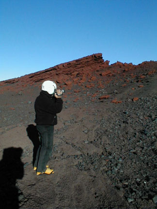
We made stops at seven different cones. Each was unique. The second one featured tilted layers of bright red rock. Chris kept the helicopter running as Tim jumped out to get rock samples and Peter filmed his progress. This was a quick stop so he kept on his flight helmet, this added to the illusion that he was an astronaut sampling a different planet. By studying these rare places on our planet maybe we'll learn a little more about all planets including Mars.
After midnight we made one long stop. The sun had set behind the summit of Mt. Morning and we were in the cold shadows. I brought out the food and people sampled the sandwiches juice drinks and snacks. They thanked me. I felt like I had played a role on this mission. When the food energy hit them minutes later they went right back to hard work.
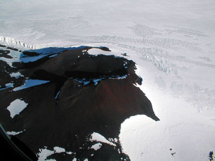
After four hours of doing geology from the air and on the ground we finished the last mission of this field season. We flew back toward McMurdo. As we flew I noted one last treat for me the amateur geologist, we were flying over patterned ground. It looked like alligator skin. Snow filled-in the cracks between the polygons made by freezing and thawing of the ground over thousands of years. Patterned ground shouted out that this was a place where water froze and thawed this was Earth.
The mission was over. We were headed home. The people in the helicopter looked at each other and smiled. The trip had one lasting effect on me, the memories of the wild lands have left me with the faint trace of a smile.
Thanks Terry.
|
Scientific Explorations with Paul Doherty |
|
10 Dec 2000 |